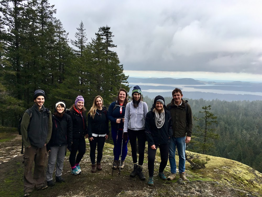
This past BC Family Day weekend, myself and some of my “Group Hikes Near Vancouver” crew (such awesome people!) hiked Salt Spring Island. Read on below for some information about our adventures including where we camped, some awesome Salt Spring Island hiking trails, a bit of island history and more.
How to Get There
For those of you who may not be familiar, Salt Spring Island is one of British Columbia’s famous Gulf Islands. Just off the coast of southern Vancouver Island, Salt Spring Island’s Long Harbour can be accessed by a direct 1 hr 20 min ferry from the Tsawwassen ferry terminal near Vancouver, (or you can take a 35 minute ferry to Fulford Harbour from Victoria or to Vesuvius Bay via a 25 minute ferry from Crofton [near Nanaimo on Vancouver Island]). You can also fly directly to the island from Vancouver (and elsewhere) with a variety of airlines like Harbour Air and Salt Spring Air.
A Bit of Background
Located in the Strait of Georgia (locally called the Salish Sea), the Gulf Islands are a great destination getaway from Vancouver city life. Salt Spring Island, one of the Southern Gulf Islands, is the most populous and the biggest of all the Gulf Islands at 193.5 square kilometres. It is also the most developed. They have every amenity you can think of including a hospital, schools, banks, restaurants, grocery stores, etc. They even have their own currency and flag! Still, however, it maintains a quaint, small-town feel.
Salt Spring was the first of the Gulf Islands to be settled and the first agricultural settlement on the islands in the Colony of Vancouver Island. It was initially inhabited by various Salishan peoples who called it xʷənen̕əč before it was settled by pioneers in 1859. At the time, it named Admiral Island (circa 1858) by Captain Richards, after his superior officer Rear Admiral Baynes. The local residents of the time insisted on calling it Salt Spring, because of the 14 or 15 natural saline springs that occur on the island. Eventually, the mapmakers renamed it officially. Historical facts courtesy of Wikipedia and local Realtor Li Read.
Hiking Trails
Given the size of the island, you can probably guess there are a ton of hiking trails. As we only had 1.5 days available to explore during our trip, we hiked what I researched to be the most scenic: Mount Erskine, Mount Maxwell, and Reginald Hill. All located in the southern end of the island, they all lived up to their reputations. Gorgeous, gorgeous, gorgeous.
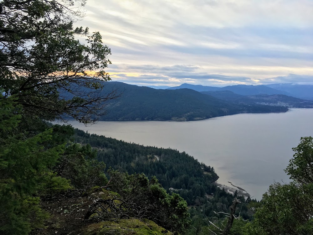
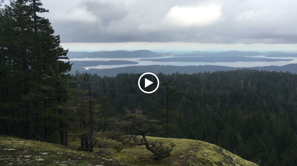
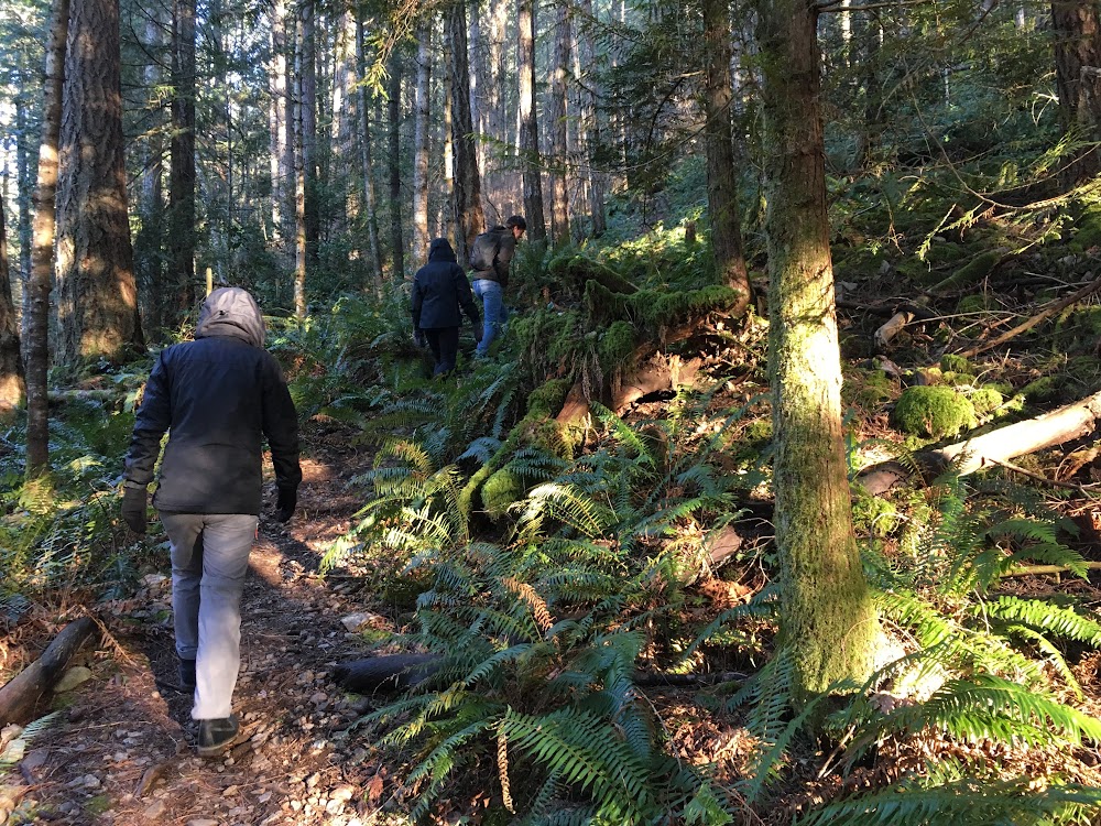
Mount Erskine
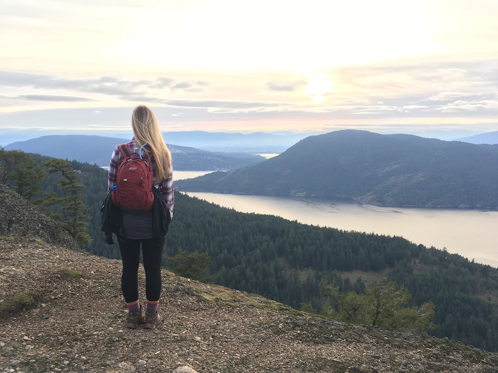
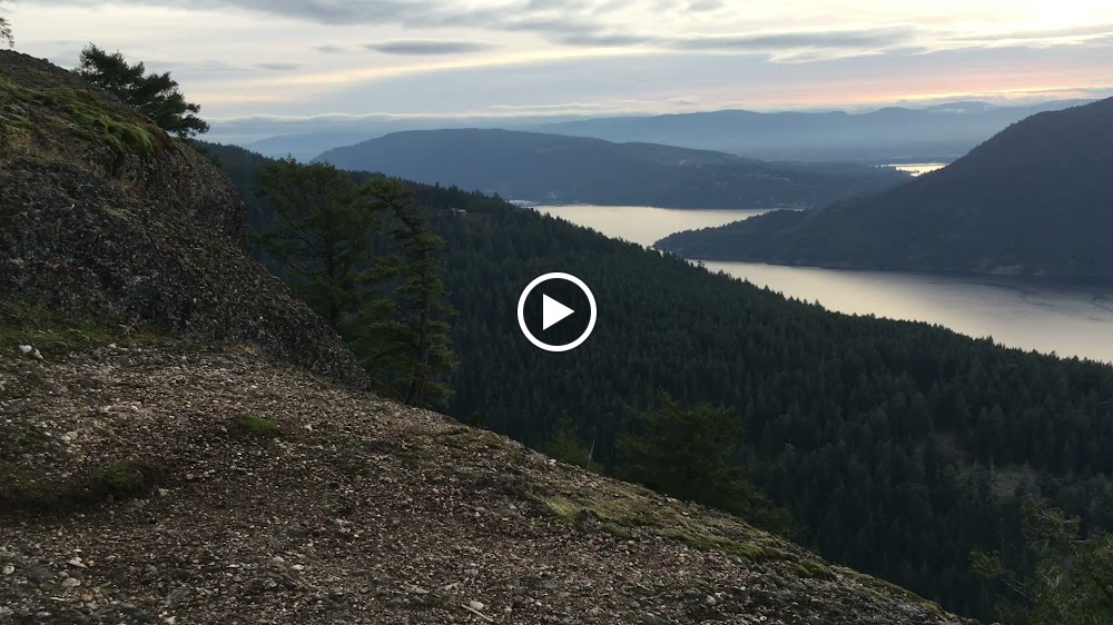
We did a quick evening hike up here on our first day to watch the sunset.
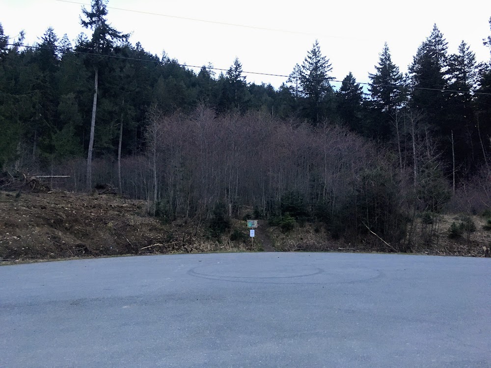
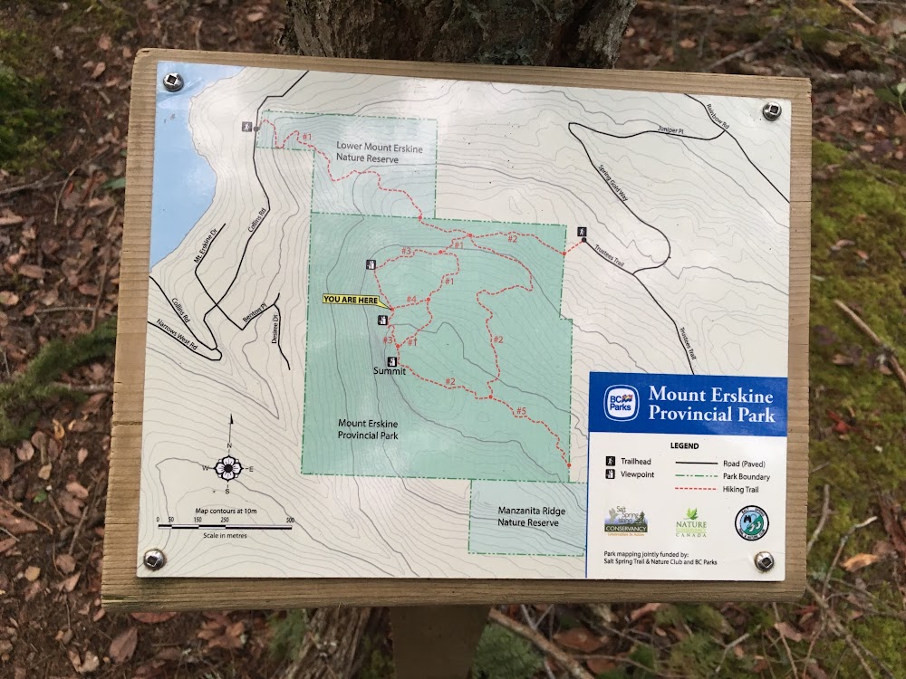
Trailhead
The trailhead we started at was at the end of a cul de sac at the end of the road called Trustees Trail, just off Juniper Pl (see map below).
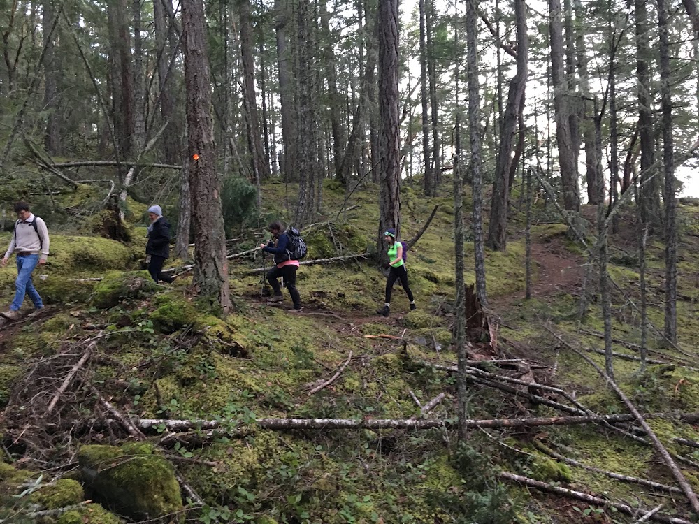
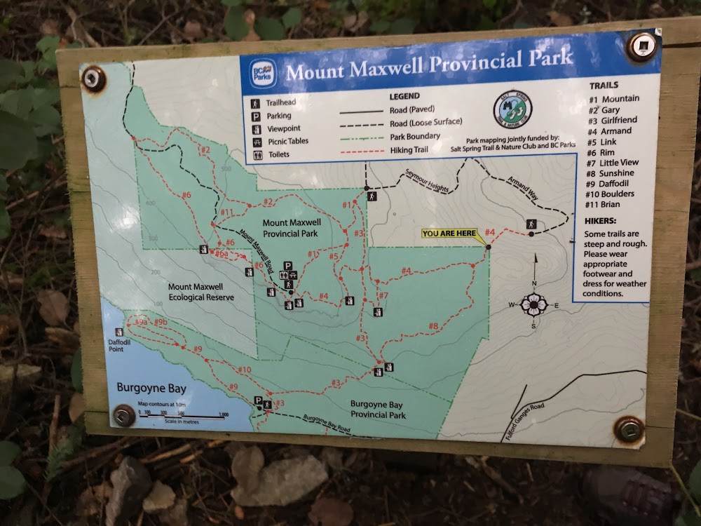
All the trails we encountered on Salt Spring are incredibly well-marked. The trail map has numbers on each route, as do all the trail markers. At all trail junctions, there is a small map on a post too. It’s a very organized island for hiking!
Curious how I got these stats? I track all my activities using my Garmin Fenix3 HR watch.
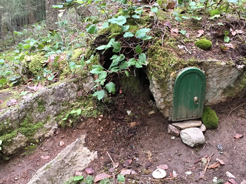
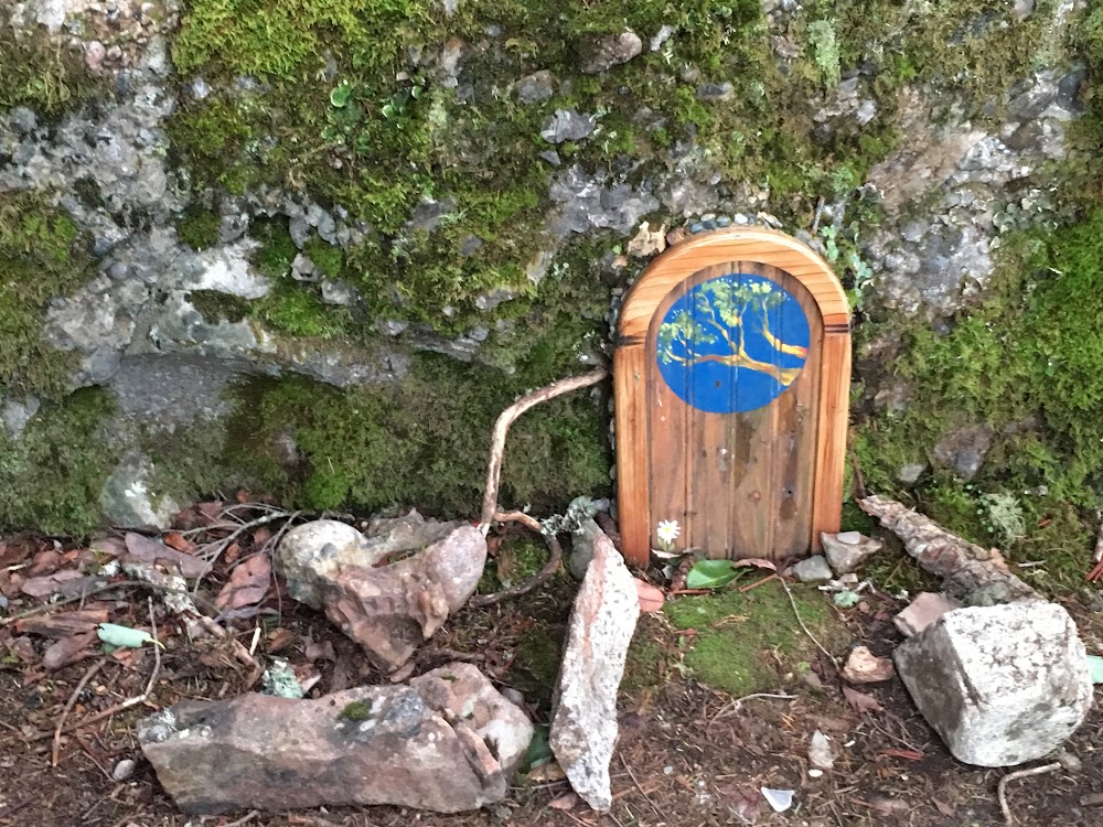
It was a short, steep hike through the forest with a few cute little fairy doors along the way. From the top, you get a sweeping view west over Vancouver Island.
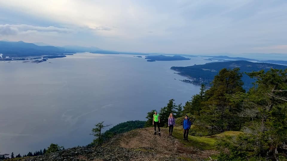
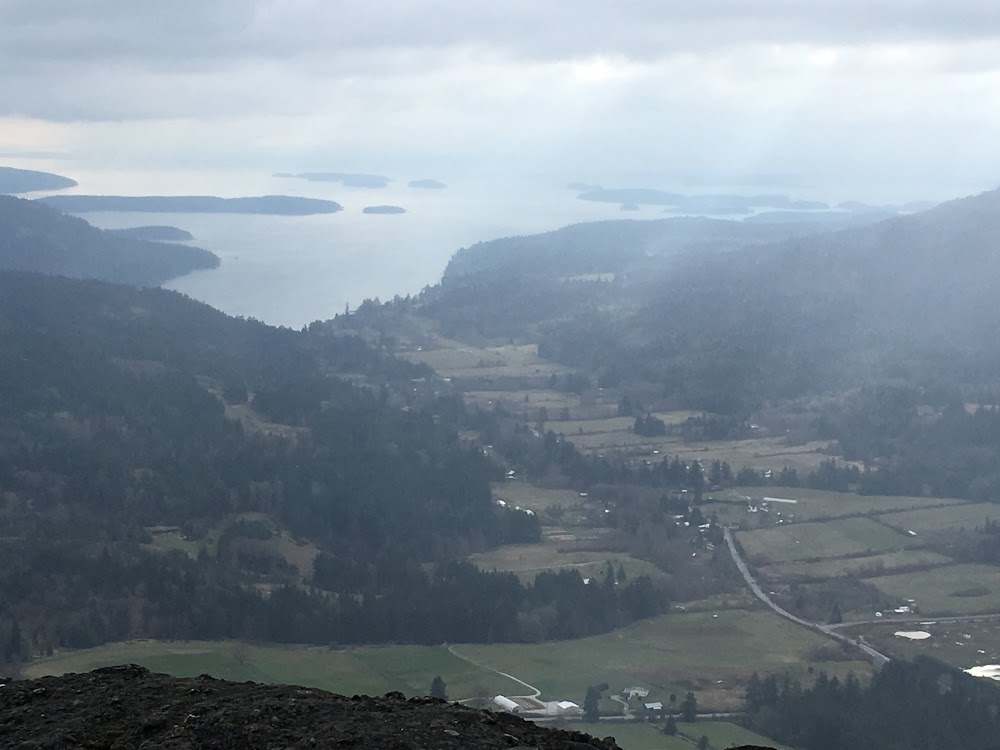
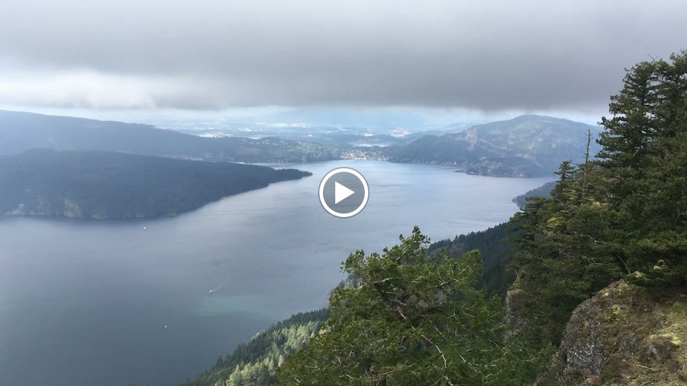
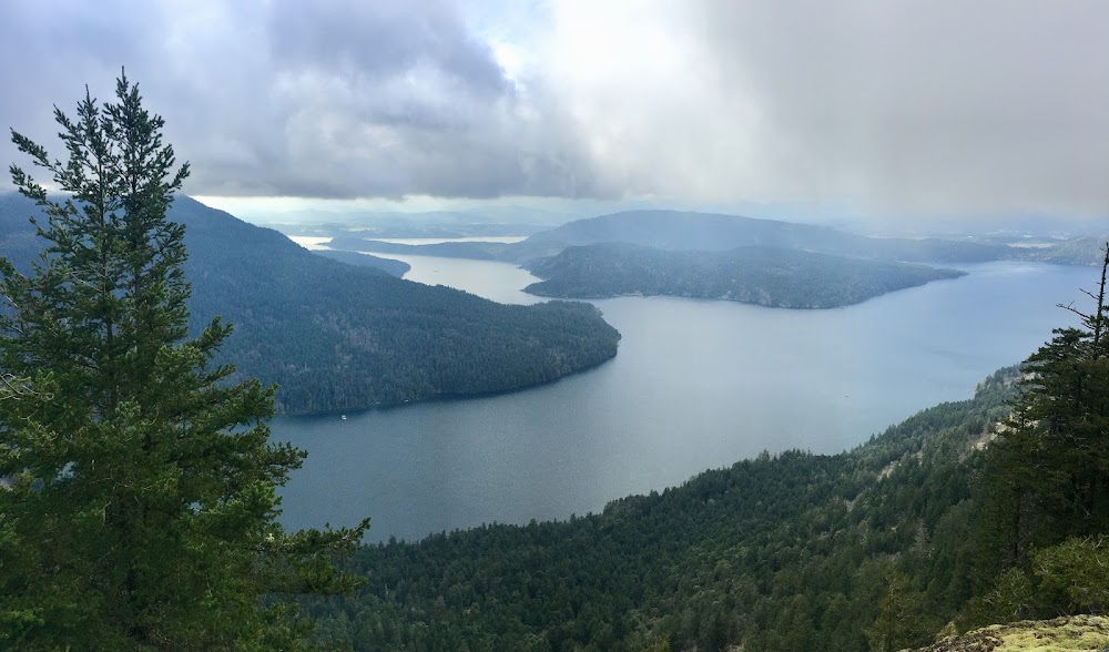
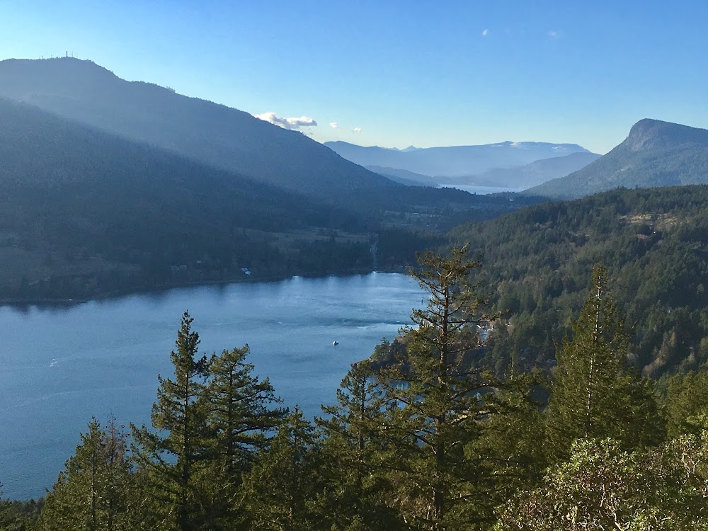
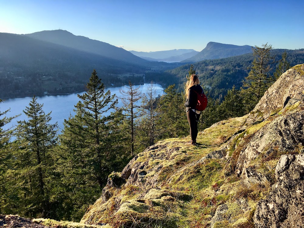
Mount Maxwell/Baynes Peak
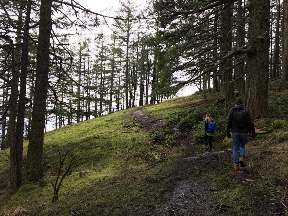
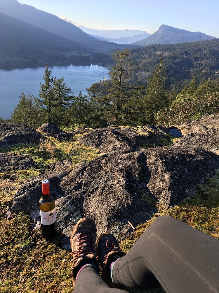
It was a cloudy morning with some snow flurries when we tackled this hike. Luckily the sun peaked through the clouds a little bit. We hiked the Armand route (#4) up to the top of Mount Maxwell Road (Baynes Peak), looped around #1 Mountain trail and #5 Link trail before meeting up with the Armand route again to head back down to the car. The photo below is from the viewpoint at the top of the road.
Trailhead
The trailhead we started at was at the end of Armand Way (see map below).
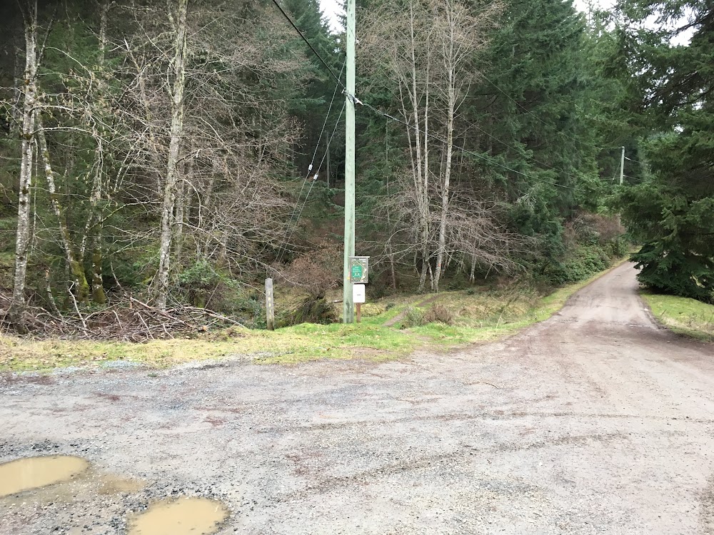
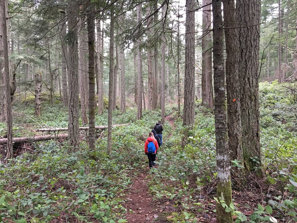
The trail was undulating with some short, steep sections, but overall, a fairly moderate route. It is completely forested until you reach the top and then there are many viewpoints that open up to overlook Burgoyne Bay.
Just before the first viewpoint:
From the viewing area the top of Mount Maxwell Road:
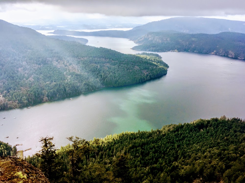
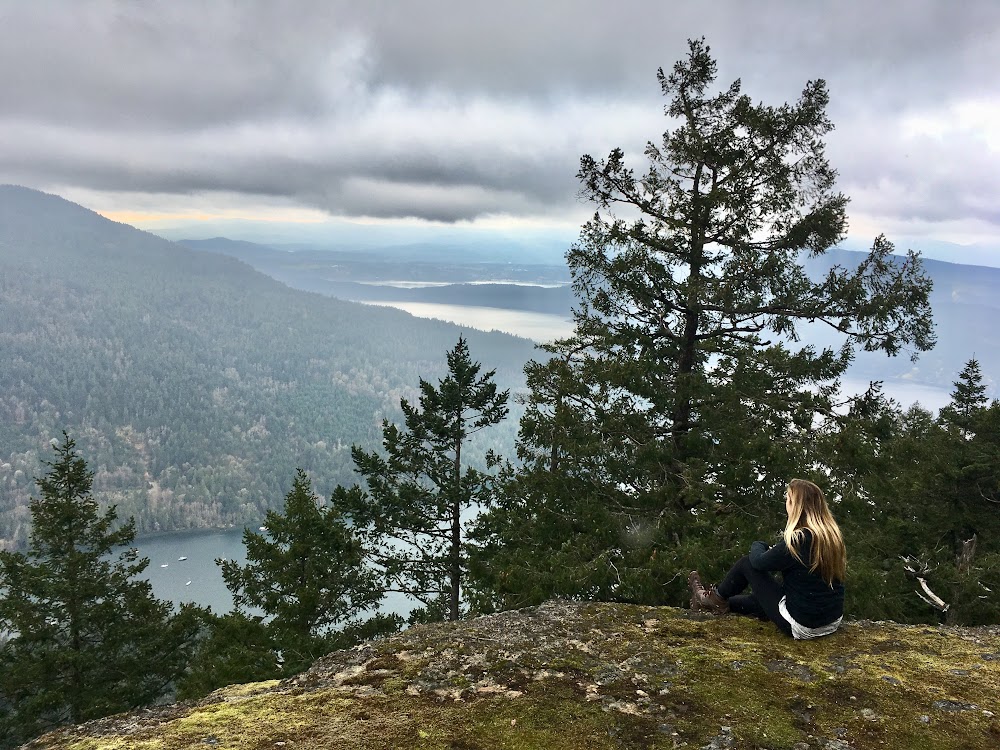
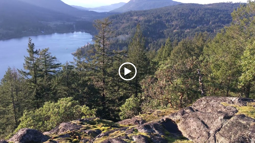
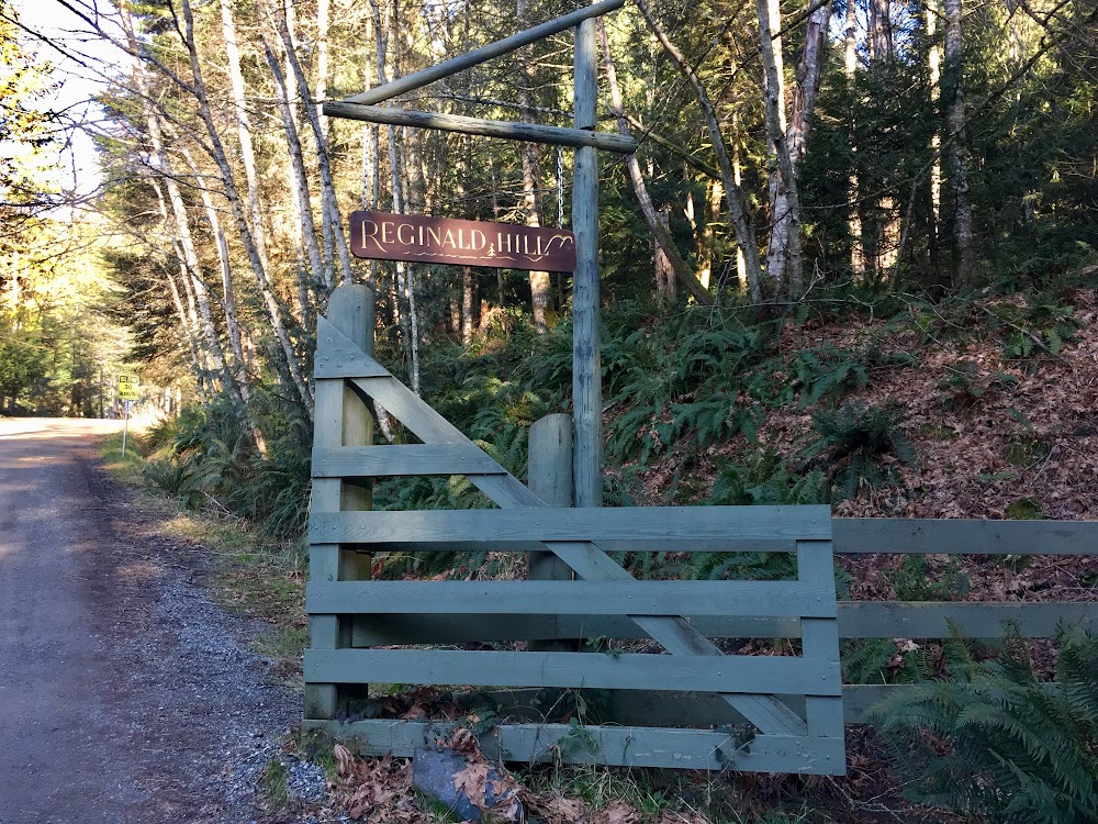
Reginald Hill
After we hiked to Baynes Peak (Mount Maxwell), we took a quick lunch break at the Salt Spring Island Cheese Company. I quickly shovelled some crackers topped with delicious fresh goat cheese and fig preserve into my mouth and then headed back out to enjoy the sunshine that finally made an appearance as we descended Mount Maxwell. Just a short 15 minute drive from our campsite at Ruckle Provincial Park, a few of us headed out to hike the short, steep trail up to Reginald Hill.
Trailhead
The trailhead we started at was on Reginald Hill Road, just after you turn off Morningside Road (see map below).
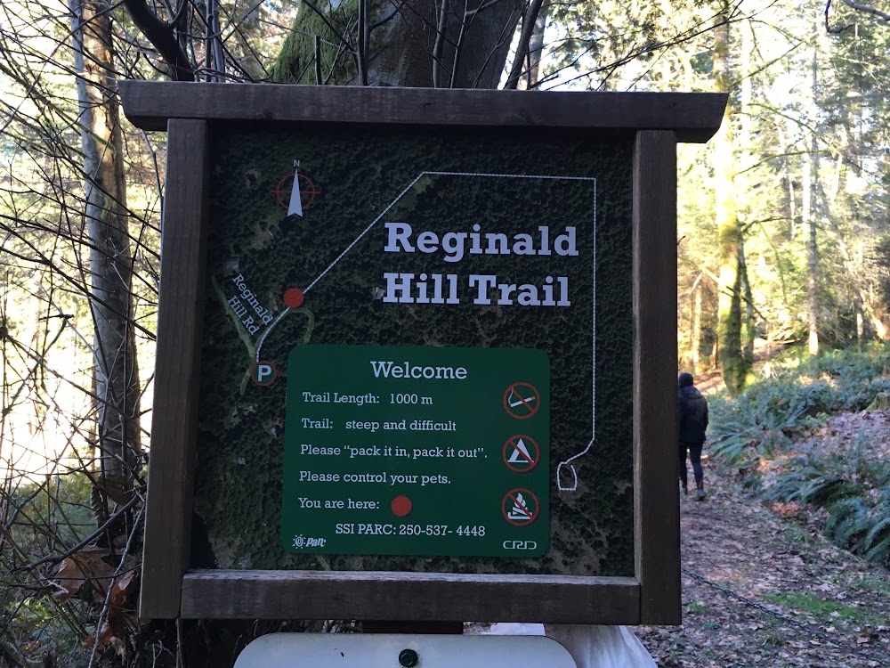
The trail was very short and steep but well worth the effort. It climbs through a beautiful forest full of lush ferns and Arbutus trees, before popping you up to an exposed area looking west over the southern point of Salt Spring and north into Fulford Harbour.

Hiking all day means I deserve a treat for sunset right? Shoutout to one of my favourite BC wineries Road 13 Vineyards for making my day that much sweeter, and to Merrell Canada for my fave hiking boots, the Moab FST Mid Waterproof for getting me up to these stunning vistas.
And to these troopers for mustering up the energy to join me on a second hike after a long, cold day!
Other Hikes
Next time I visit I’d like to hike to the highest points on the island, Mount Bruce and Mount Taum.
Some easy Salt Spring Island hiking trails include those in Ruckle Provincial Park, Peter Arnell Park, Mouat Park, Duck Creek Park, Channel Ridge and more. A great resource to learn about hiking trails on the island is the Salt Spring Market website.
Camping
We camped at Ruckle Provincial Park at the end of Beaver Point Road at the easternmost point of Salt Spring Island.
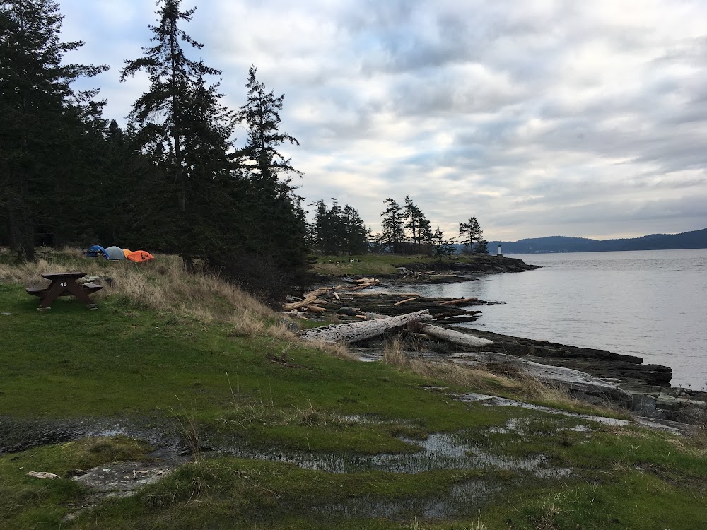
Some of us slept in our vehicles and others in tents so we took a couple RV spots in the forest.
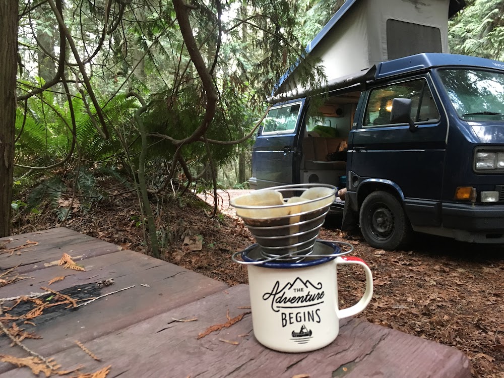
Want my awesome mug? You can buy it here.
I know it was a long weekend, but given it’s the middle of winter I was quite surprised at how busy it was. I imagine it’s probably jam-packed in summer so if you’re planning on going then, make sure you make a reservation asap.
Some tips for camping there in winter:
- The water is shut off so make sure you bring lots of water. Local businesses are really nice and will allow you to fill up if you’re in town though.
- It was FREEZING. Our first night it went down to -3 C. My sleeping bag is rated down to -12 C and I had my silk liner and I was still frozen dressed in many layers of merino wool and down. I got creative my second night and was super toasty warm. I filled my Nalgene bottle with boiling water and hugged it all night, as well I wrapped myself in my emergency blanket (part of the 10 Essentials you should always have hiking!), cocooning myself in my sleeping bag so that none of my makeshift hot water bottle heat escaped. Finally a toasty night sleep!
- My Victorinox Swiss Army Knife came in handy a number of times. From opening that non-screwtop wine bottle, to opening a tin of beans, to whittling marshmallow roasting sticks, it did it all.
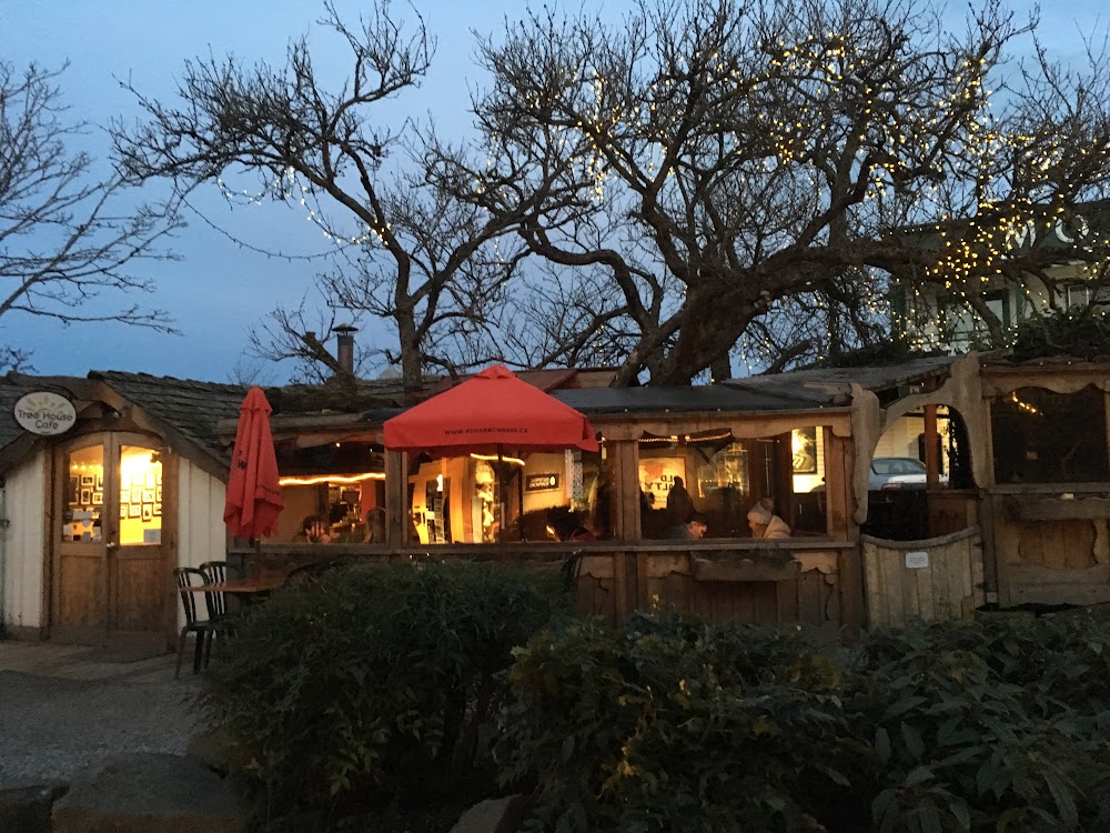
We made most of our meals over our campfire, but we didn’t want to miss out on the great dining spots the island is famous for so we ventured over The Tree House on Saturday night. It’s a small place so it was very busy and we had to wait 45 minutes to get a table altogether (8 of us), but those deluxe burgers sure were worth it!
All in all, it was a great weekend. The island is massive and there is so much to see and do. We maximized our time and did a lot of stuff but I know we didn’t even scratch the surface. I’m looking forward to heading back for many more fantastic adventures. Please let me know if you have any recommendations!
Learn even more about awesome hiking near Vancouver by subscribing to our semi-annual e-newsletter and following us on Instagram!
[wdi_feed id=”1″]